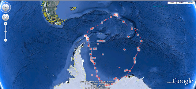
 Google Earth
Google Earth is a web application that allows teachers across the curriculum to bring topics to life. In the case of the example that I have place here, Earnest Shackleton's Antarctic Expedition, it tracks the time that they were stranded in the ice off of Antarctica. As the class reads through Shackleton's journal of the expedition they can record specific dates and locations of events.
Accessing Shackleton's journal will connect a class to several different parts that are key to understanding. The scientific knowledge such as the forces exerted by ice on the ship, or climactic conditions and how they changed during the time they were in the ice. Again, the details in the journal can be critical for what they experienced, but the understanding comes with time and discussion.
Possible Questions
How did the sailors keep track of their location? How were they able to survive so long on the ice without being resupplied? What did it take for them to finally get out of the ice? Why did no members of the expedition die?
This sample of Google Earth shows the Shakleton Expedition and the territory they covered during their time near Antarctica. Teachers or students can add informational tags to each point to explain things that had happened. They can even add information about geological features or animal behaviors to the story.


No comments:
Post a Comment
Be sure to play nice and don't make me get my teacher voice out.